CODAP › Forums › CODAP Help Forum › Mapping Worldwide Latitude and Longitude
Tagged: maps
- This topic has 1 reply, 2 voices, and was last updated 6 years, 5 months ago by
Bill Finzer.
-
AuthorPosts
-
Michelle Wilkerson
ParticipantHi, CODAP team! Thanks for all of your work with this great tool.
I have some questions/issues concerning the display of maps of datasets with “worldwide” latitude/longitude data points. I think this is more a question about managing this particular interface feature, rather than a “bug” in the strict sense:
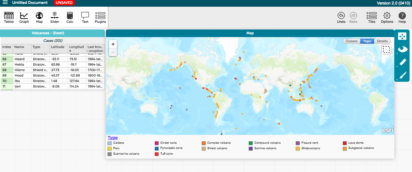
We have been playing around with earthquake and volcano datasets, like this one. In cases like these, datapoints map to the entire world map. If you stretch the map window (we stretched it in the saved document linked to in the previous sentence), you’ll see the map itself “wraps” – so that a new Asia appears to the further-left of the Americas that have overlaid data points, or new Americas appear to the further-right of Asia. Those do not have data points overlaid. It makes sense that they might not, because it may be confusing or difficult to make sense of duplicate data points within the same window. But it introduces two issues:
(1) In some cases (like with earthquakes and volcanos), you may want to re-organize where the “cut” of the map is. Many students in my case wanted to reposition the graph to see the “ring of fire”, but it’s cut right in the middle.
(2) Once students scroll the data points off the screen by moving the map to the left or right (and it may wrap more than once if you click and “throw” to the right or left), some had trouble finding which of the left- or right- repetitions of the world map actually had the data points on it.
I *think* the easiest way to deal with this is to restrict the map to only displaying once, with both the map and the overlaid data points being draggable across a wrapped topology. That would require two different behaviors: (1) When I resize the window, in cases where the whole world is shown, the world stretches/compresses so that only one whole world is still shown. And, (2) When I pull the map to the left or the right, the portion that is scrolled off-screen appears on the opposite screen with the data points still overlaid. This way I could, for example, move the map to the left or right half-an-earth in order to position the Ring of Fire at the center of the display. But those are obviously shaped by our very specific use of the feature.
-
This topic was modified 6 years, 5 months ago by
Michelle Wilkerson. Reason: remove tags
Attachments:
October 29, 2017 at 5:38 pm #428Bill Finzer
KeymasterHi Michelle,
Great suggestions. You inspired me to look carefully at the options offered by Leaflet, the library underlying CODAP’s map tool. I found ‘worldJump,’ which, when set to true, does part of what you describe. Namely, when you scroll the map horizontally far enough, say to the right, the map wraps and you start seeing points on the left that you had previously scrolled off to the right. This options lessens the likelihood that you’ll get “lost” and be unable to find your data. (Though note that the Rescale button at the top of the map’s tool palette scales the map so that all the data is visible.) Expect to see this enhancement in an upcoming release, perhaps 0412.
Unfortunately, the worldJump option still only allows you to see “one world” at a time, so you can still only see half the ring of fire at once. To help with this, consider using a formula for Longitude such as
if(Longitude_< cutPoint, 360+Longitude_, Longitude_)
where Longitude_ is the original longitude, and cutPoint is the value of a slider. Here is your example modified to include a cutPoint slider.
I’ll have to think a bit more about how hard it would be for us to force map points to automatically plot in whatever world is showing. It seems like it might not be too hard.
So, thanks for your excellent suggestions! You are helping to make CODAP a better educational platform.
Bill
-
This topic was modified 6 years, 5 months ago by
-
AuthorPosts
- You must be logged in to reply to this topic.